THE JUMOLHARI BASE CAMP/ YAKSA TREK
This 8-day trek from Shana to Paro combines high-altitude hiking, alpine scenery and cultural encounters. It passes through yak pastures, forests, and mountain ridges, with highlights including Jangothang Base Camp, Bang Tue La Pass (15,600′), Takalung La (14,400′), and stunning views of Chomolhari and Jitchu Drake. The trek also offers opportunities to observe traditional Bhutanese villages, yak herders, and diverse Himalayan landscapes.
In essence: An immersive adventure blending challenging trekking, breathtaking peaks, and Bhutanese culture.
itinerary
Distance: 11.2 miles/Elevation Gain: 1,624′
Drive the winding road north-west up the Pa Chu to Drukgyel, the ruined dzong which once defended this valley from Tibetan invasion. This fortress, now a burned shell, was once strategic in Bhutan’s defence against Tibetan invasion. Mt.Chomolhari, the sacred summit, reaches skyward beyond the Dzong. The road ends and the trek begins, following the river gently uphill through a narrowing agricultural valley. Many farms line the valley. 4-5 hours of walking this first day. Tented Camp
Distance: 14.5 miles/Elevation Gain: 2,559′ Elevation Loss: 0
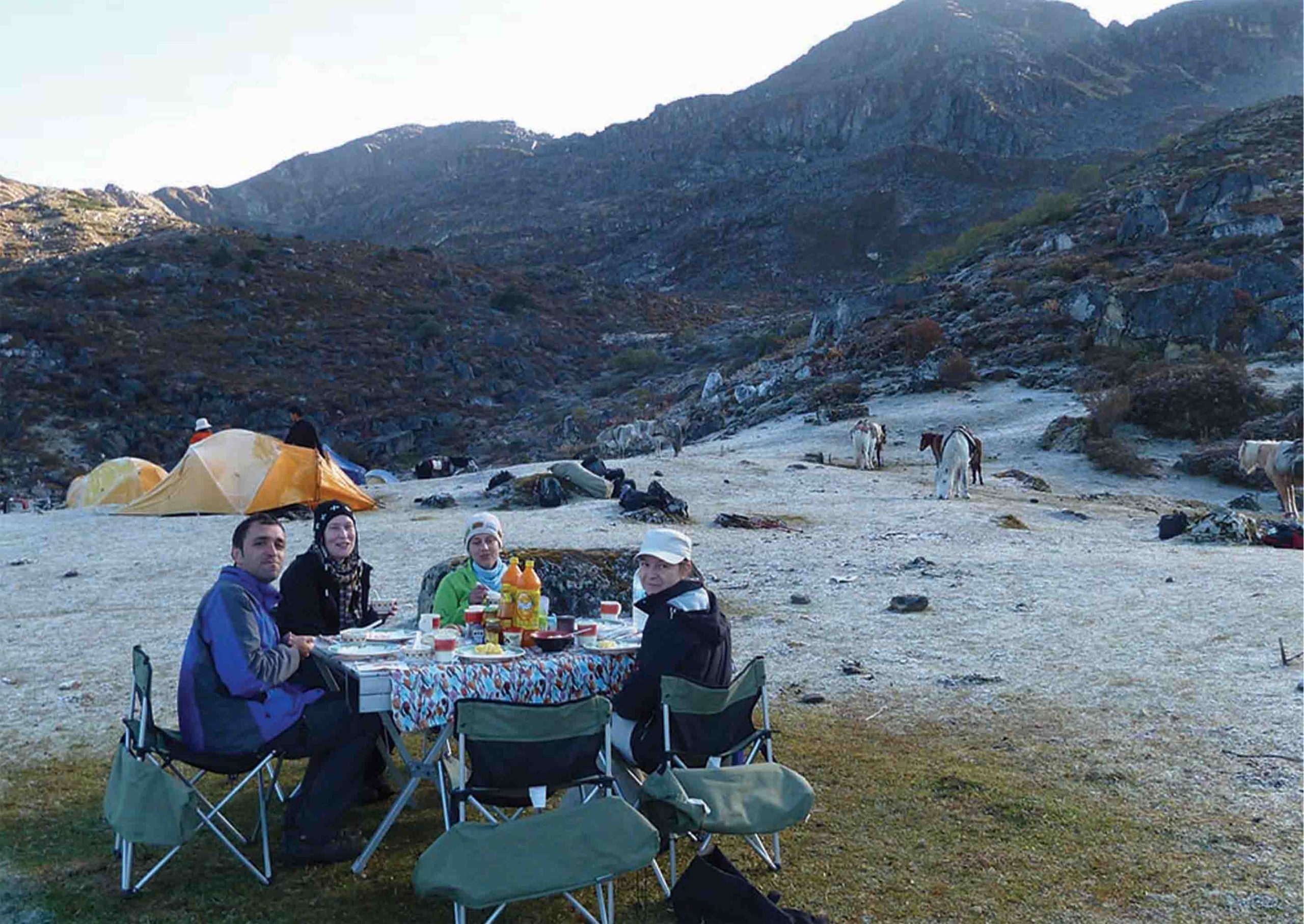
Today is more challenging as the trail continues uphill through the river valley. It narrows and closes in and the trail winds up and down along the drainage. Camp is in a meadow with stone shelter the government has built for trekkers. There are views of Chomolhari as you reach camp which make an excellent photo opportunity. Overnight in camp. 7-8 hours of walking today
Distance: 9.9 miles/Elevation Gain: 1,674′ Elevation Loss: 0 On up the Pa Chu.
Pass a small army post where the valley begins to widen again. Now views of high ridges and then snow-capped peaks are all around. Camp beneath a ruined fortress at the base of Chomolhari.. 4-5 hours of walking today
“rest” today. There are stupendous day-hikes in 3 directions. Chomolhari and it’s subsidiary are directly west, Jichu Drake to the north, unclimbed summits and ridges to the east.
Starting elevation: 13,100′ at Jangothang Ending
Elevation: 12300’ at Chorapang
Elevation gain: 1000′ Elevation loss: 0′
Approximate mileage: 9.5 miles
Today, we tackle the Bang Tue La (Pass) which is the highest point on our trek at 15,600′. An early start is recommended to allow enough time to reach camp and to get over the pass in the morning when the weather is the most stable. The trail crosses the river and begins to climb up to the lakes. A steep climb for about 45 minutes with spectacular views of Jitchu Drake and Chomolhari which grow more and more impressive as you gain altitude. Once you reach the top of the plateau, the trail will level out and after crossing a small hill, the first lake will come into view. This is a spectacular walk with the three major peaks rising above the valley, a broad stream on your right and snow covered peaks in the distance. These two lakes were stocked with brown trout in the 1960′s by H.R.H. Prince Namgyal Wangchuk.
After Tsophu, the trail leaves the valley floor and begins the climb to the pass with a steep traverse of a scree slope. As we near the top of this first incline, we cross a small glacial stream. The trail winds up and into an upper valley, with snow capped peaks in the distance. We skirt several streams and a small lake as we make our way towards the final climb to the pass. Be on the lookout for Blue Sheep on the steep hillsides above the valley. In the fall, the sheep gather together in herds numbering up to 500 individuals. In addition to the Blue Sheep, there are several Snow Leopard which live in this region.
As we climb, we will pace ourselves to allow our bodies to adjust to the elevation. At a slow pace, we should be at the pass by approximately 11:00 a.m.
From the pass, the trail drops quickly to a huge grass-covered plateau dotted with yak herder tent stone circles. To the right is a massive cliff with waterfalls and a vast scree field below. The valley of Soi Yaksa is an incredibly scenic box canyon which ends abruptly at the foot of the steep cliff. Above the canyon floor, the landscape is comprised of cliffs, waterfalls and higher still, snow covered peaks. Above the cliff to our right, the mountain rises to a dramatic point, resembling the throne of a local deity.
As we ramble through the steep grazing fields, we can see the edge of the plateau which ends with a final descent to the valley floor and our camp site beside a rushing stream.
Camp
Starting elevation: 12,300′ at Chorapang (camp along river in Soi Yaksa Valley)
Ending elevation: 13,123′ at Thangbue Elevation gain: 2132′ up to Takalung La
Elevation loss: 1312′ down from Takalung La
Approximate mileage: 6.84 miles
We climb steadily for 600 feet above the camp and then the trails levels out and winds around a ridge and crosses a stream. Another steep climb to a small pass marked by several small chortens. We stopped for a brief tea break and then continue, now above tree line, past one yak herder tent and herds of grazing yak. We reach the next valley which has a beautiful snow fed river.
We cross the river and begin the climb to the pass. It is steep, but we take our time and after one and a half hours we reach our second pass, The Takalung La at 14,400′. From the pass, we can see the large valley of Thangbue and our campsite for the night. A gently winding trail leads us downhill to our camp.
If the weather cooperates, the view from the pass is spectacular, with Chomolhari and Jitchu Drake rising over the mountain range we covered yesterday. We have a clear view of the Bang Tue La, (yesterday’s pass), and the Soi Yaksa Valley. Thangbue is a wide valley filled with yak herder encampments, many yaks, horses, and a few goats.
Camp
Starting elevation: 13,200′ at Thangbue
Ending elevation: 9482′ at Shana
Elevation gain: 722′ up to Thangbue La
Elevation loss: 4440′ down from Thangbue La to Shana
Approximate mileage: 19.2 miles
Our trail climbs steeply from camp up the side of a mountain covered with dwarf rhododendron. It is a relatively short but steep climb to the small pass. From this point, we begin a wonderful part of our trek route. For almost two hours, we walk along a ridgeline trail with drop offs to the valley floors below on both sides. If it is clear, there are panoramic views of the major peaks and distant valleys.
Eventually we drop down from the high ridge and we begin to glimpse views of another dramatic peak, Drake Gang. Like Jitchu Drake, it is the residence of a local male deity, while Chomolhari is the home of Jomo, a female deity. We were now in an area of rocky cliffs and parapets which faded in and out of the mist. We dropped further to a lovely spot with views of the valleys below us. We stop for a tea break while enjoying the view.
From this tranquil spot, we begin one of our most challenging parts of the trek. For the next three hours, we dropped steeply on a switchback trail losing about 4500 feet. The trail again is littered with many stones which make footing challenging. Taking our time (and watching our knees!), we descend to the valley floor. As we lose elevation, the landscape changes from alpine with dwarf rhododendrons to lush pine forests with huge old growth trees. Even lower, we entered a mixed forest of pine and oak.
For the remaining journey from Shana to Drukyel Dzong, we enjoy the relatively flat (compared to the walk from Thangbue!) walk to the road head. Upon arrival at Drukyel, we will be met by the staff and vehicles and drive back to the hotel.
(Note: This itinerary is a sample itinerary intended to give you a general idea of trip to Bhutan. We can tailor an itinerary to suit your requirements and interests. Please Contact Us to design the exact itinerary for you)